For churches using the GoogleCalendar–Display.Church integration, we have added a new feature that automatically pulls in Google Maps images to enrich your event details. This aligns with our “set it and forget it” philosophy – you can continue to manually add events to your Google Calendar as usual, including the location, time, and other key information.
Google Maps photos
If you enable the option to display Google’s map photos (when available), Display.Church will fetch the relevant images for your event and incorporate them into the event listing. Now, Display.Church integrates with the Google Places API. So, we can pull in these photos and add them to your event details.
This one-pager will include compelling visuals and details to help people understand the event, which is particularly important if you want to encourage attendance. By providing images and information that showcase the location and what to expect, you offer potential attendees valuable perspective and insight.
How it works
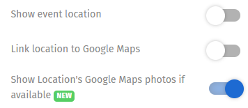
In the Design tab, Events section of the Display.Church calendar you wish to work with, toggle on Show Location’s Google Maps photo if available.

Toggle this button on
NOTE >>>
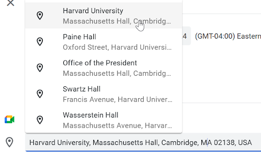
When setting your event up in your Google Calendar, you need to make sure that you have chosen your location from Google’s location list. You do not have to, of course. However, if you do not, Google will not have a location photo and you will not see any image even if you toggle on the button.

Choose from the Google locations list
Why this helps your church digital marketing
Ultimately, the more attractive and informative your event posting is, with strong social proof and visual elements, the more likely people will be interested in attending. It’s not just about making the event look pretty, but about providing the key details people need to feel comfortable and confident in their decision to participate.
We believe this new Google Places integration feature will be a powerful tool in helping you create compelling event pages that drive attendance and engagement.
Read more here about showing location’s Google Maps photo if available.
Display, event details, Google Maps, location

